|
Updated February 16, 2008 |
||||
| These first pictures are not of the trip, but a few from just before we left that somehow never got posted. | ||||
|
Sunrise off Hamilton Beach | ||||
|
The Pilothouse -- No Trim, but Much as it Will Be Otherwise |
||||
|
The Galley Peninsula Being Assembled | ||||
|
So Now on to the Trip
| ||||
| We had a beautiful day for the run down Chesapeake Bay and arrived in the traffic off Hampton Roads in the early afternoon. Since we were determined to push on and get to work on the boat and on other projects, we did not linger in Norfolk but anchored for the night just under the oldest naval hospital in the country. The passage south through the Elizabeth River is complicated by several drawbridges, but we studied their opening times and had no difficulties. At the first bridge we had a radio call from the tug Elis , pushing a loaded barge around the bend on the other side, so we waited a few minutes for him to come through. | ||||
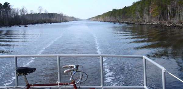
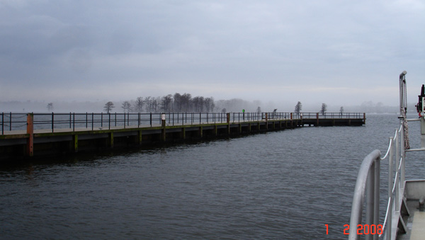
A Typical Stretch of the "Virginia Cut" (the Albemarle and Chesapeake Canal) |
There is an elaborate courtesy on Channel 13 (the harbor and river working channel on the VHF radio), soft
southern voices saying "Thank you, ma'am, and you have a nice day" to the bridge tenders and almost competing
to put themselves out to help the other boat.
At Norfolk we really entered the Intra-Coastal Waterway, a chain of rivers and sounds linked by dug canals. Except for an occasional tug and barge there was no traffic -- hardly surprising, since it was still | |||
| January,
the coldest month of the year (though it didn't really seem cold to us).
Here Barbara went through her first lock, where we dropped about a foot to move us from the tidal (and salt) Elizbeth River to the freshwater level of Currituck and Albemarle Sounds. The Corps of Engineers lock operator held us in the lock until jsut before the next scheduled opening of the bridge immediately south of the lock, so we didn't have to try and hold the boat in place waiting for the bridge. We spent a night at the somewhat broken-down |
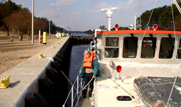
Barbara Tending the Spring Line in the Great Bridge lock | |||
|
Pungo Ferry Marina (apparently there is some kind of reorganization
going on) which is pretty well in the middle of nowhere, surrounded by swamps laced with little creeks. There is a high
bridge here and apparently there really was a ferry once, since the road runs right up to the river and stops abruptly.
| ||||
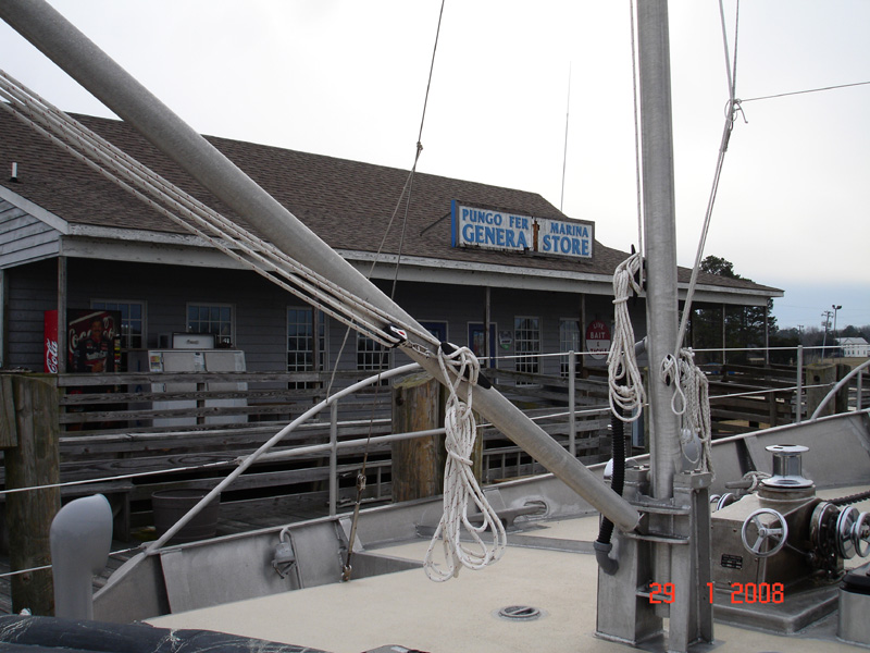
The "Pungo Fer" Marina | ||||
|
South of Pungo Ferry navigation becomes a matter of threading one's way between markers on posts, first down the course of
a winding river, then through the expanse of Currituck Sound, which is quite wide but very shallow except for the dredged channel.
The constant attention required makes long tricks at the wheel quite tiring and we were glad to trade off. After we passed Coinjock
We entered the winding North Landing River with some rather elegant horse farms on the eastern shore.
We finally broke out into the North River, where the ICW is |
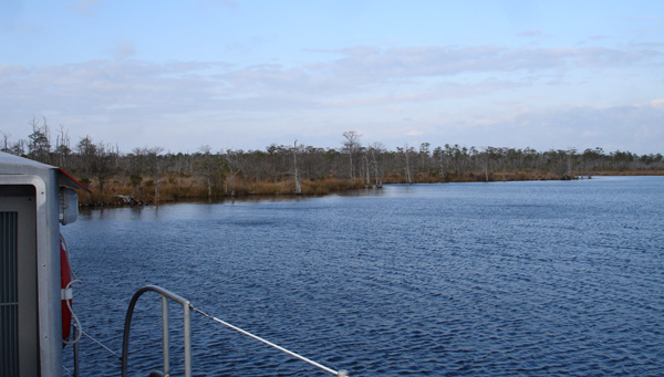
Barbara Anchored in Broad Creek | |||
| a marked channel in honest-to-goodness water and any movement ouside the channel would not produce an instant grounding. Since the next leg of our plan was the long (40 miles or so) haul west through Albemarle Sound to Edenton and it was getting late in the day, we decided to spend the night in or along the North river, and we had read in guides of a little and reportedly hard-to-find guzzle called Broad Creek, so we set out to find it. This proved not to be so hard with a little attention to the chart, and we felt out way in and anchored in about 9 feet in a little stream surrounded by marsh and full of birds. This would have been a great place to explore with the sailing skiff we intend to carry, but on this trip we were determinedly headed. We left fairly early and headed down the river and out into Albemarle sound. Now, Albemarle sound is a much-feared body of water. It is shallow and of course develops a steep chop. This day was no exception; we had a south-west wind of about 30 knots and a steep 2-4 foot chop, but Barbara chugged on unconcernedly and in due course arrived at the entrance channel to Edenton, a candidate for a place to settle for the next couple of months. |
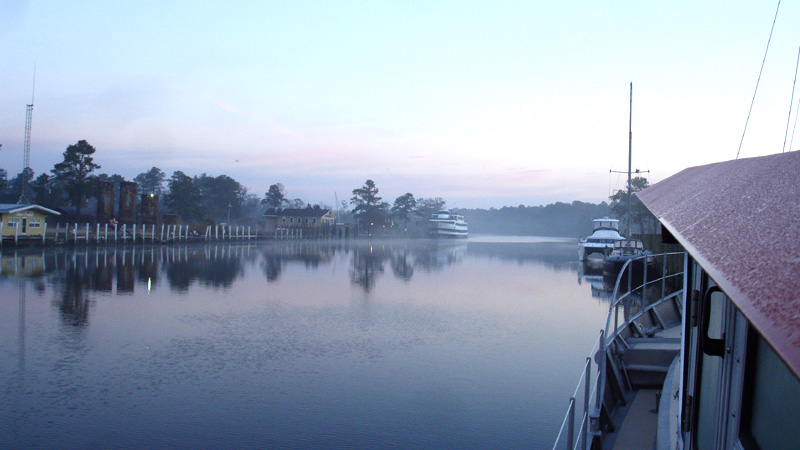
A Misty Morning at Edenton |
After scoping out the narrow entrance to its breakwater, we headed into the harbor and had a brief moment of drama when a
screw dropped out of the reverse gear control and we could not use the engine. After we tied ourselves off to the
breakwater, however, it took only a moment to fix the problem and we worked ourselves back over to the T on the town
wharf and tied up.
Edenton is a pretty town and we met some nice people there, including a very helpful salesperson in the local office of our principal marine distributor, | ||
|
but ultimately it was not a place for us to stay. Anchoring meant a wide-open exposure to the south
and a choppy dinghy ride, and the town had a time limit on its wharf, even in the winter. We considered that
we would have to go a
long way south to get to where we could count on 70°weather and decided to return to the friendly reception
we had experienced in Deltaville.
So it was that after a couple of days we started up early one morning, said goodbye to the "committee" that had come to see us off (and urge us to stay), and headed back east in beautiful weather toward the mouth of the North River. This time we continued on and arrived at Coinjock a little after lunch and decided to spend the night there. |
||||
Early Morning at Coinjock Marina" | ||||
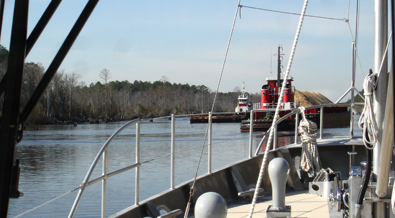
| The next morning our old friend the tug Elis came through pushing a barge loaded with wood chips just before we were ready to go, and we followed her all the way to the Great Bridge Lock. |
Typical River Section of the ICW |
|||
|
A little before the lock we heard on the radio that the tug "Island Fox" was coming south toward us pushing a loaded jumbo barge, so both
"Elis" and we stopped and tucked ourselves in among the stumps on the side of the canal to give the oncoming boat as much room as we could,
which was just barely enough.
| ||||
 Close Quarters on the Canal Close Quarters on the Canal
| ||||
| As we approached the lock, the lock tender instructed us by radio to wait until "Elis" was in the lock and secure, then pass her and tie up at the front of the lock. We left the lock first, but our fates continued to be linked, as we went through all the drawbridges together. In fact, our being in convoy, so to speak, was helpful, since some bridges were happy to open quickly for a commercial vessel, while recreational craft had to wait for a scheduled opening. | ||||
|
Coming into Norfolk we were struck again by the sheer size of the port, stretching for a long way along the Elizabeth River, and by
the many different kinds of ship. Here a dry bulk cargo ship was loading someting (cement?) from a covered conveyor, while just
down the river an enormous ship was loading coal, reminding Barbara of her childhood in coal country.
We passed by one solitary Navy ship well upriver from the Navy Yard; her bow reached almost to the edge of the channel and was fitted out with two temporary machine guns and a sentry in full battle gear with an automatic weapon in the very prow. We both found it a little spooky to be on the wrong end of such weaponry. This time we had decided to stay at a marina so we could see a little of Norfolk and also watch the superbowl; we pulled in at the Waterside Marina, run by the city, and found a place on the bulkhead between Hooters and Eat at Joe's. On the advice of the dockmaster we went to a sports bar called A.J. Gator's, where we watched the game surrounded by a raucous but very friendly Giants crowd. Of course we were disappointed by the score, but we had a pleasant evening, one that was a nice change from our usual somewhat isolated existence. |
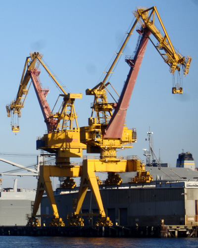
Yellow Cranes in Norfolk harbor | |||
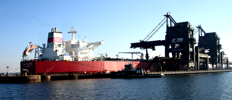
Ship Loading at the Coal Pier | ||||
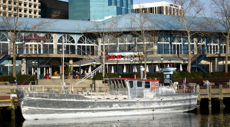
Barbara at Norfolk | ||||
|
The next morning we were up early but there was already a good deal of tug traffic on the river for us to watch as we had breakfast
and we heard radio calls from a bulker we had watched loading as we came down the river the afternoon before. It was a beautiful
morning and after breakfast we backed Barbara out of the narrow opening in the breakwater surrounding
Waterside Marina and headed down the river toward Chesapeake Bay.
The huge Navy Yard had been very quiet when we went by on our way south, but this time we heard one "security" call after another: "warship X departing . . . " We had to pay pretty close attention as they slid out into the river from their piers and as a fleet oiler was pulled out by tugs and headed toward the oil tanks of Craney Island. Finally, as a carrier prepared to get underway, it became clear that we were seeing a battle group moving out and we wondered where they were headed. | ||||
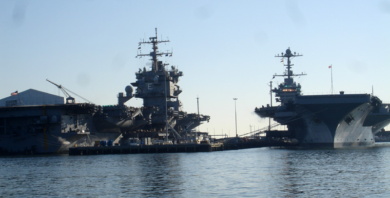
Aircraft Carriers Lined Up | ||||
|
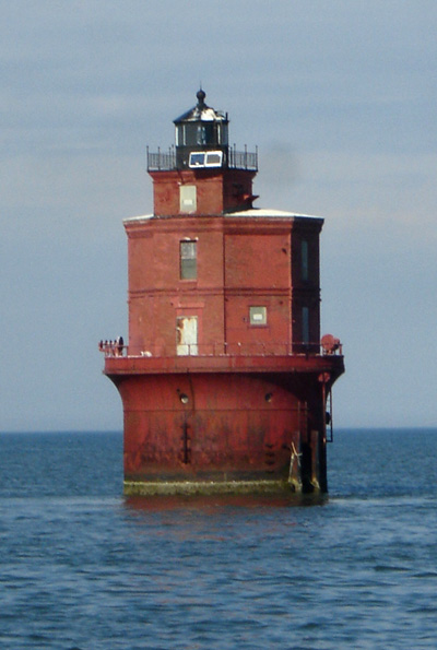
 Thimble Shoal Light
 | |||
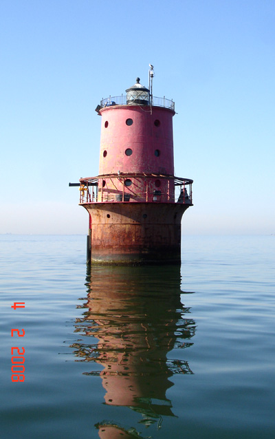
 Wolftrap Shoal Light
 | ||||
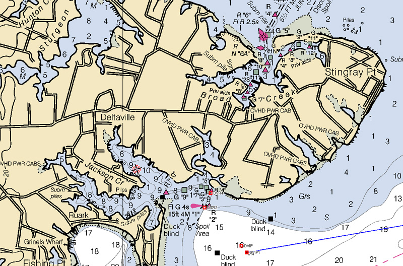
Deltaville (Jackson Creek) - To the North of Stingray Point is the Mouth of the Rappahannock River | ||||